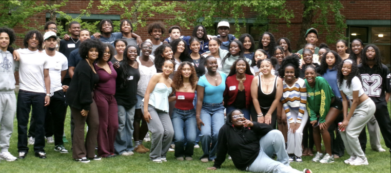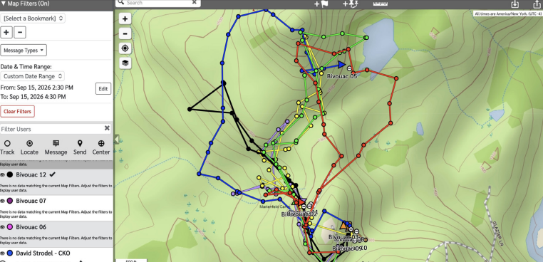
On the afternoon in September 2025 when Josie Ruiz, Celia Shigley, Vivian Zhang and Victoria Wilson (all ’29) went out on the Map and Compass course at Bivouac, they certainly didn’t expect that a search party would need to come looking for them later that evening. However, after losing track of their location in the woods, they walked in the wrong direction and ended up lost for hours, 2.5 miles from the Bivouac property.
“At first we didn’t take in that we were actually lost,” Victoria said. “But then it got to a point where we were like we actually might spend the night here. And when it got to that point, it was kind of scary.”
Almost every Upper School (US) student has participated in Map and Compass at Bivouac, a course where students search for flags hidden in the woods, navigating with just a map and a compass. Until September 2025, when the team of four got lost, no group had been seriously missing for a prolonged period. This incident led faculty to reevaluate the safety of Map and Compass as part of their continuous effort to improve and adapt Bivouac.
According to Lukas Wellesley ’26, a Junior Guide (JG) who was helping with Map and Compass on the day of the incident, after some time spent waiting for the four lost freshmen to return, a search began. This initial effort was led by Math Teacher Chip Rollinson, who sets up the Map and Compass course, and included several JGs.
“Mr. Rollinson was like, ‘You patrol the road. Yell their names. And I’ll go around on every flag and check for them,’” Lukas said.
However, their efforts proved unsuccessful due to the lost team’s distance from the camp. Other search efforts, involving multiple guides and vehicles, failed as well. Eventually the lost freshmen reached a road with houses and were able to get in touch with US faculty.
“We used the number on the map, and then we called the guide’s phone, and it didn’t work,” Josie said. “So then we called my mom because I have her number memorized. She’s a teacher, so she was able to call Ms. Farlow and tell her, ‘Can you go pick up the girls?’”
Mr. Rollinson said it was stressful while the group’s whereabouts were unknown.
“At the time, it was definitely a bit scary for both the students who were lost and the Bivouac guides and JGs who were involved,” he said. “We were all very relieved when the girls were found and were safe.”
In past years, other teams have been lost. However, what made this particular situation so concerning for the US faculty was how long the four freshmen were missing.
“I don’t recall that we had ever had a group that hadn’t returned or been found much past 5:30 p.m., well before dark. Last year, it was around 7:20 p.m. when we learned the team’s location, after sunset, which made us really think deeply about both immediate and future changes to the course to do our best to ensure something similar does not happen again,” Mr. Rollinson said.
In light of this incident, it became clear that the safety of the Map and Compass course needed to be reevaluated.
“In the months that followed, after much discussion with other guides, including many meetings with Mr. Strodel and lots of research into different technology options, we settled on also issuing two pieces of technology to each team, a GPS tracker and a two-way radio,” Mr. Rollinson said.
This new technology now provides students with a way to easily communicate with guides and JGs in the event that they are lost or there is an emergency. It can allow teams to focus more on the challenge.
“It is good to feel like there is someone looking out for you there,” Charlie Weigold ’30, who recently returned from Bivouac, said. “The guides made it feel like it wasn’t so bad if you got lost. It was relatively easy to get back with all the resources they gave us. Being lost wasn’t super threatening.”
He believes that if not for the new system, his team might have been more cautious and less competitive.
“We maybe wouldn’t have gone for the furthest points and the furthest flags immediately,” he said. “It did feel like there was a little bit of a safety net there if we needed it.”
Setti Sekhavat ’30 agrees safety equipment provided peace of mind.
“We go pretty far away from Biv, but with all the new GPS and stuff, there were so many different ways for us to get help,” she said. “With the walkie-talkie, all we have to do is press a button, and then we can instantly communicate with anybody that we need.”
Bivouac Director and Science Teacher David Strodel ’78 said safety is paramount to the Bivouac experience.
“We are constantly evaluating every single aspect of the program to make sure it is beneficial, effective and above all, safe,” he said. “This happens both in real-time and post-program. In this case of the Map and Compass course, we especially appreciate how our protocol modifications will not only bolster our ability to track students as they participate, but also allow the exploration and applied learning aspects of the Bivouac program to continue.”